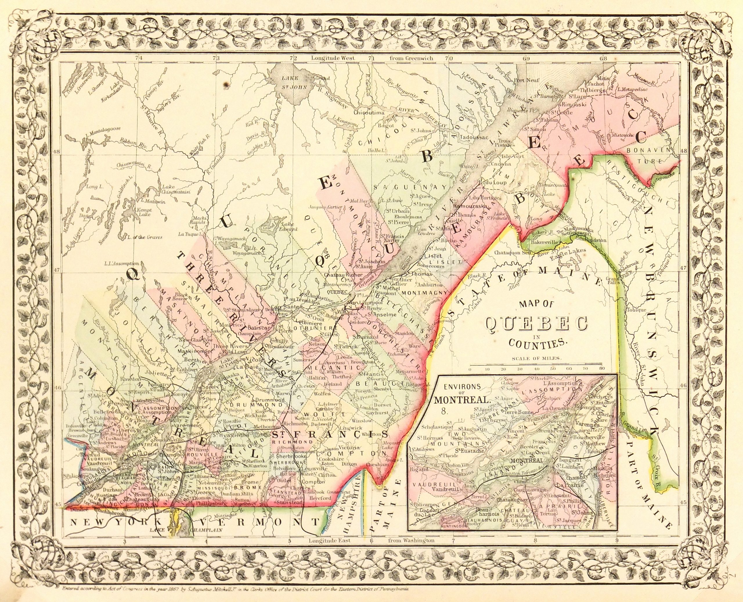
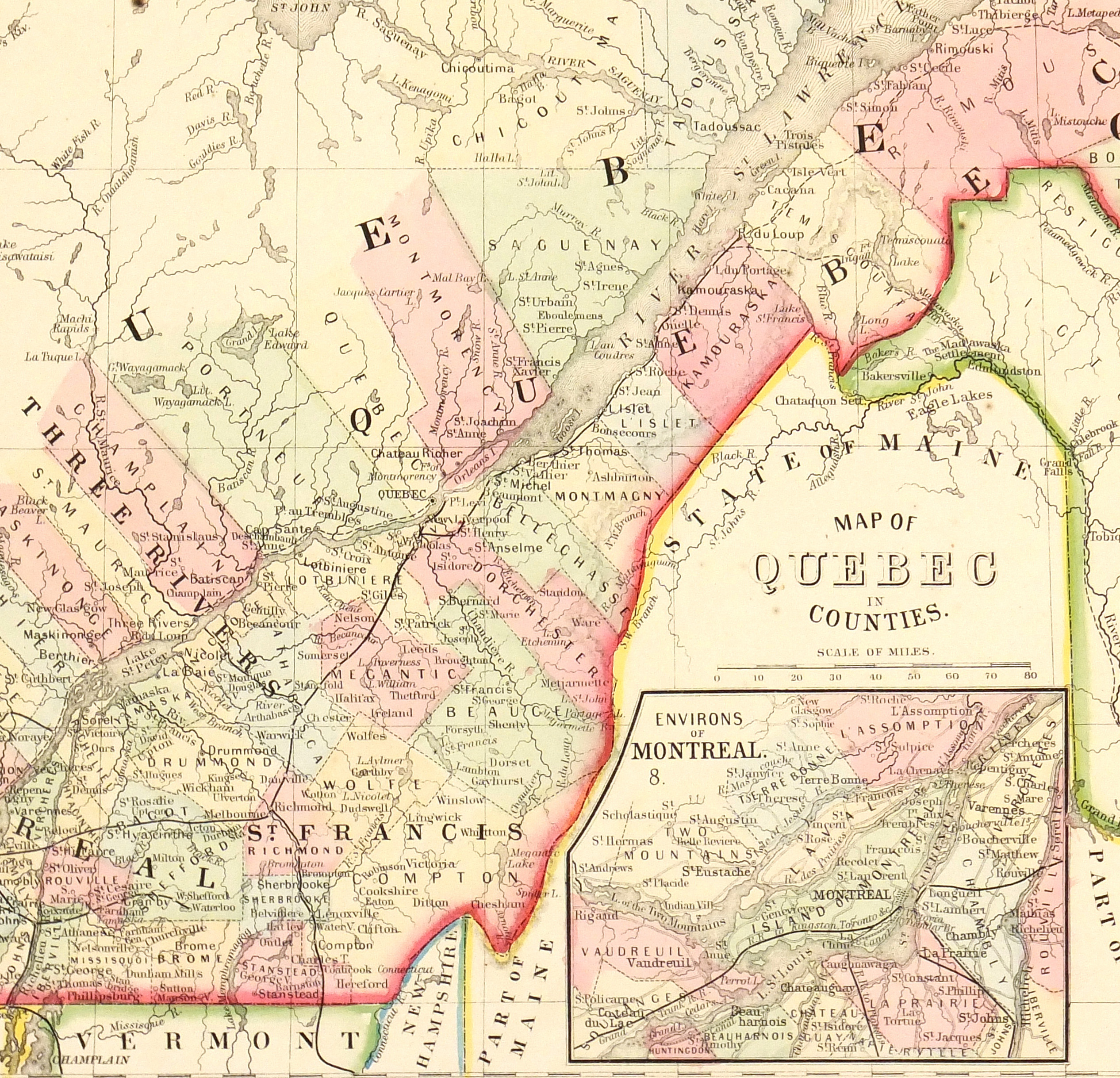


Description
Fascinating map of Quebec, Canada, showing rivers, lakes, railroads, counties and towns. Note northern counties extending outwards and inset of Montreal. American engraving with original hand-color from 1867.
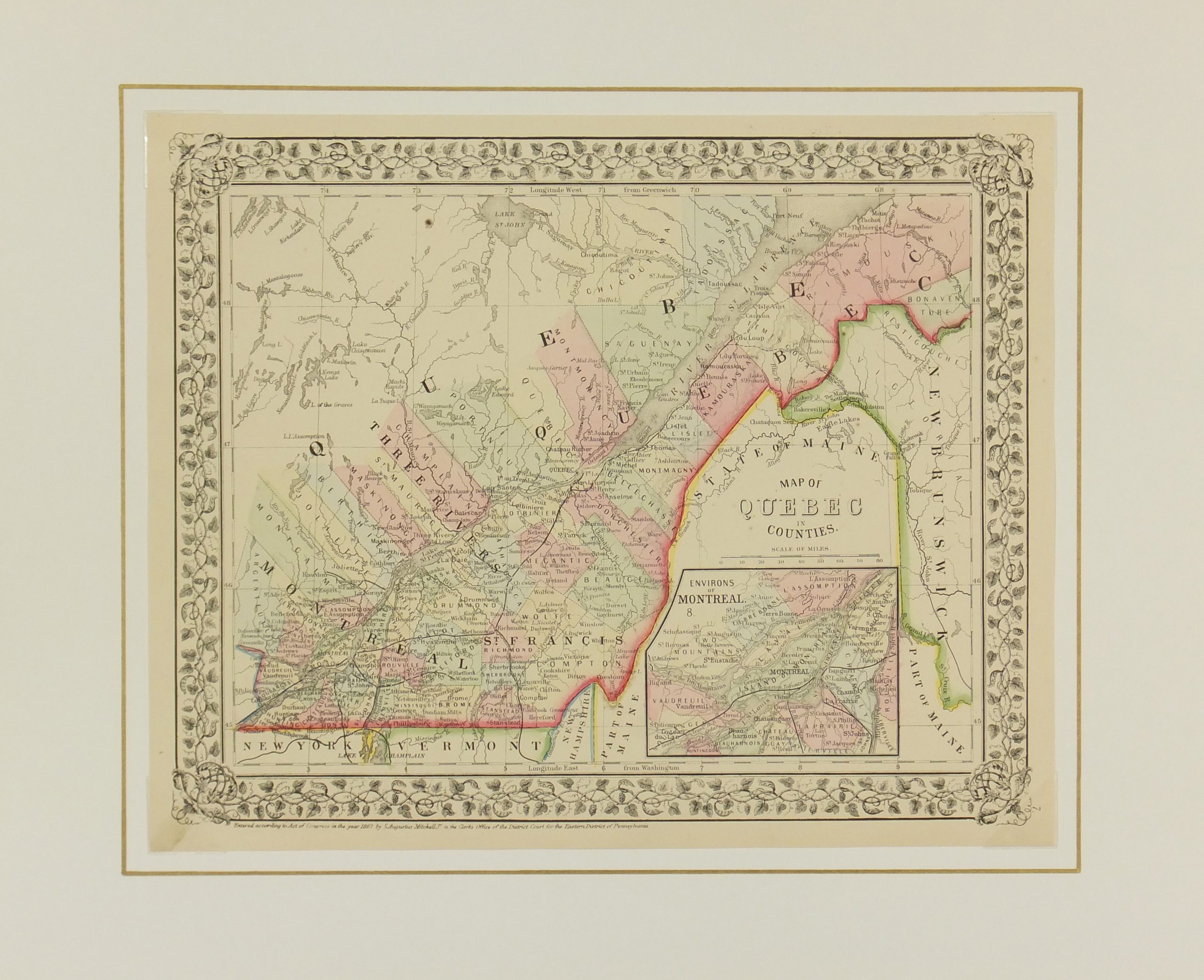
Original antique map on paper displayed on a white mat with a gold border. Mat fits a standard-size frame. Archival plastic sleeve and Certificate of Authenticity included. Map, 14.25″L x 11.5″H; mat, 20″L x 16″H.