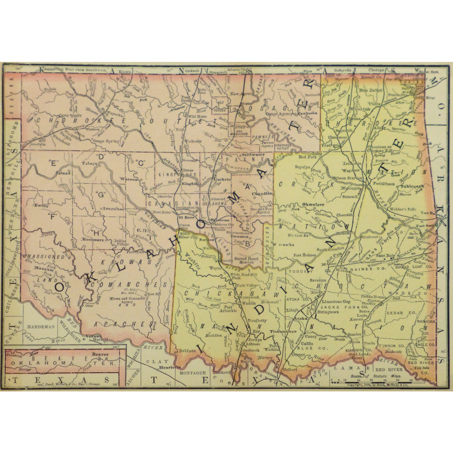
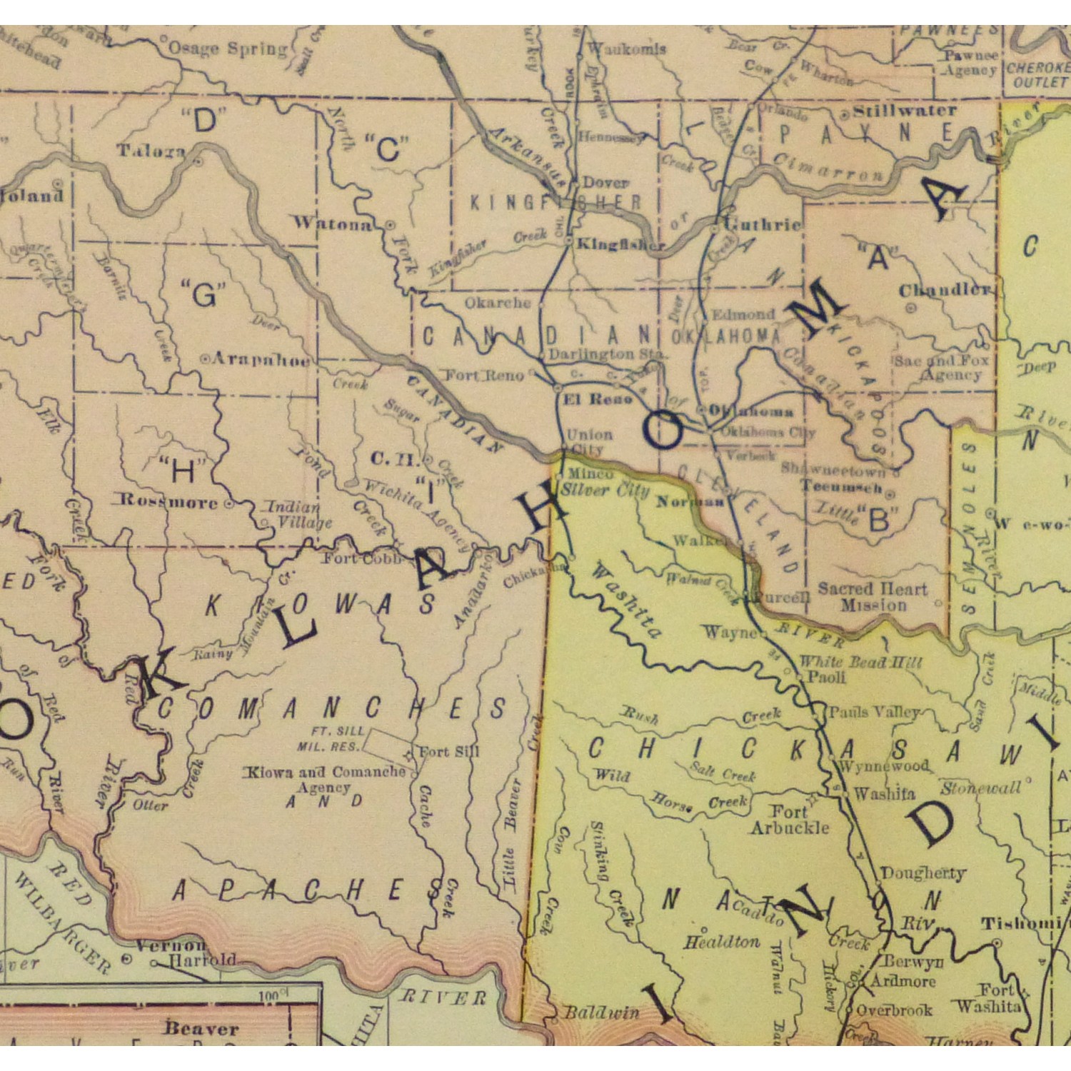
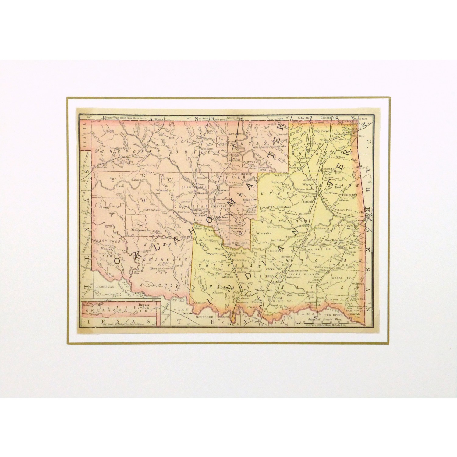
Map – Indian & Oklahoma Territory, 1891

$100.00

Interesting and colorful map outlining the Indian territory borders of Oklahoma from Rand McNally, 1891

Out of stock

SHARE:

Email
Compare
SKU: 9242M Categories: , ,

Description

Interesting and colorful map outlining the Indian territory borders of Oklahoma from Rand McNally, 1891

Original antique map on paper displayed on a white mat with a gold border. Mat fits a standard-size frame. Archival plastic sleeve and Certificate of Authenticity included. Map, 10.25″L x 7.75″H; mat, 16″L x 12″H.


Additional information

Color

Oranges, Yellows

Country of Origin

USA

Date

1850-1900

Media

Lithography

Size

Small

Condition

Very good; center fold as issued