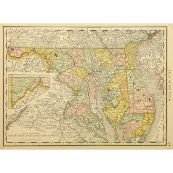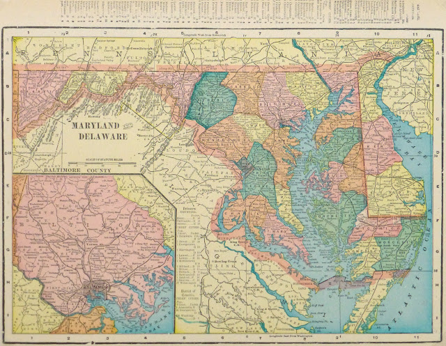

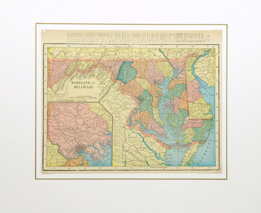


Description
Colorful map of the states of Maryland and Delaware from 1903. Shows counties, towns, rivers, and railroads. Note fascinating list of town populations upper margin.
Original antique map on paper displayed on a white mat with a gold border. Mat fits a standard-size frame. Archival plastic sleeve and Certificate of Authenticity included. Map, 13″L x 10.25″H; mat, 20″L x 16″H.