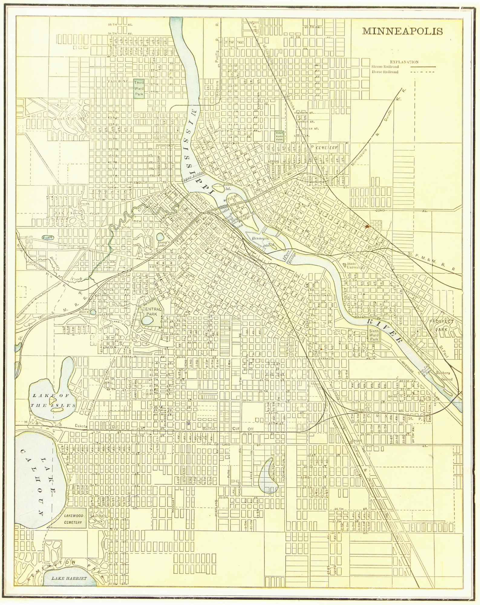
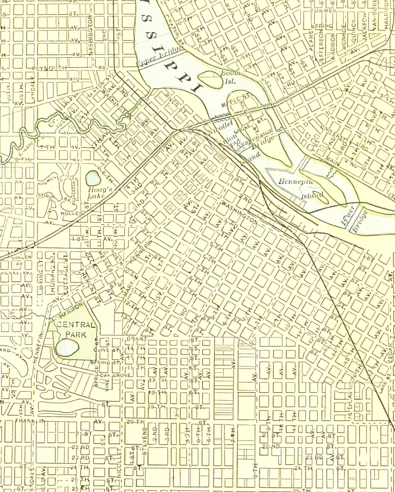
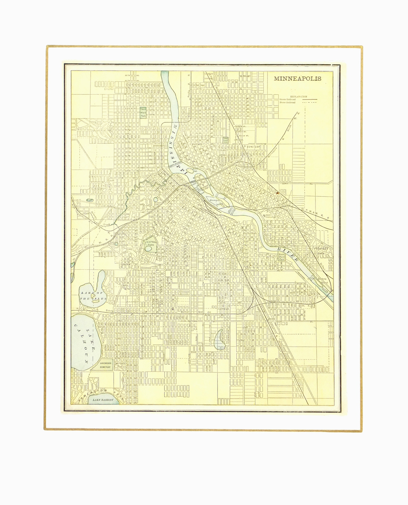


Description
Antique map of Minneapolis from 1889. Shows main buildings, transport, parks, bridges and streets. Note index lower right and horse and steam railroad routes.
Original antique map on paper displayed on a white mat with a gold border. Mat fits a standard-size frame. Archival plastic sleeve and Certificate of Authenticity included. Map, 10.25″L x 12.75″H; mat, 16″L x 20″H.