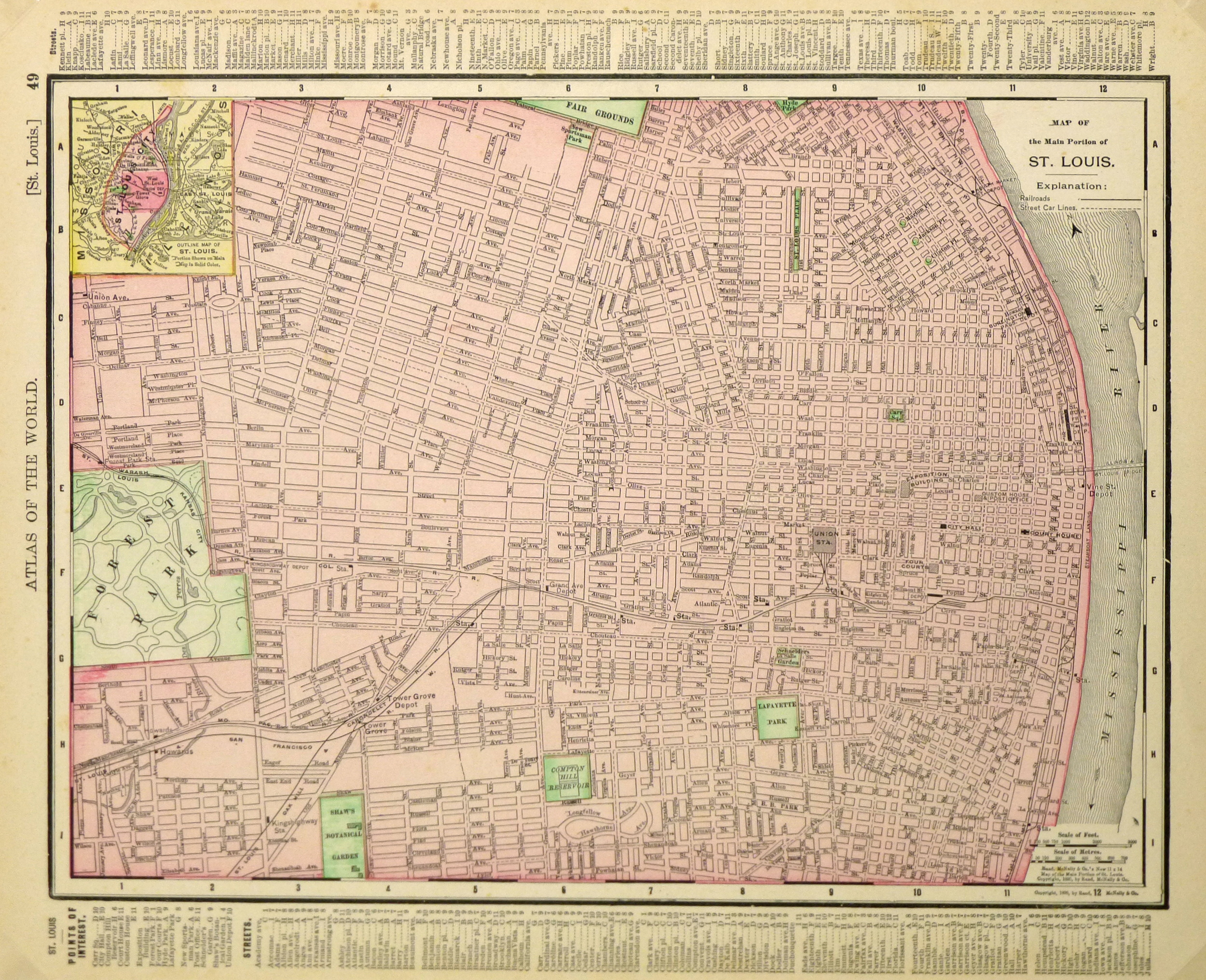
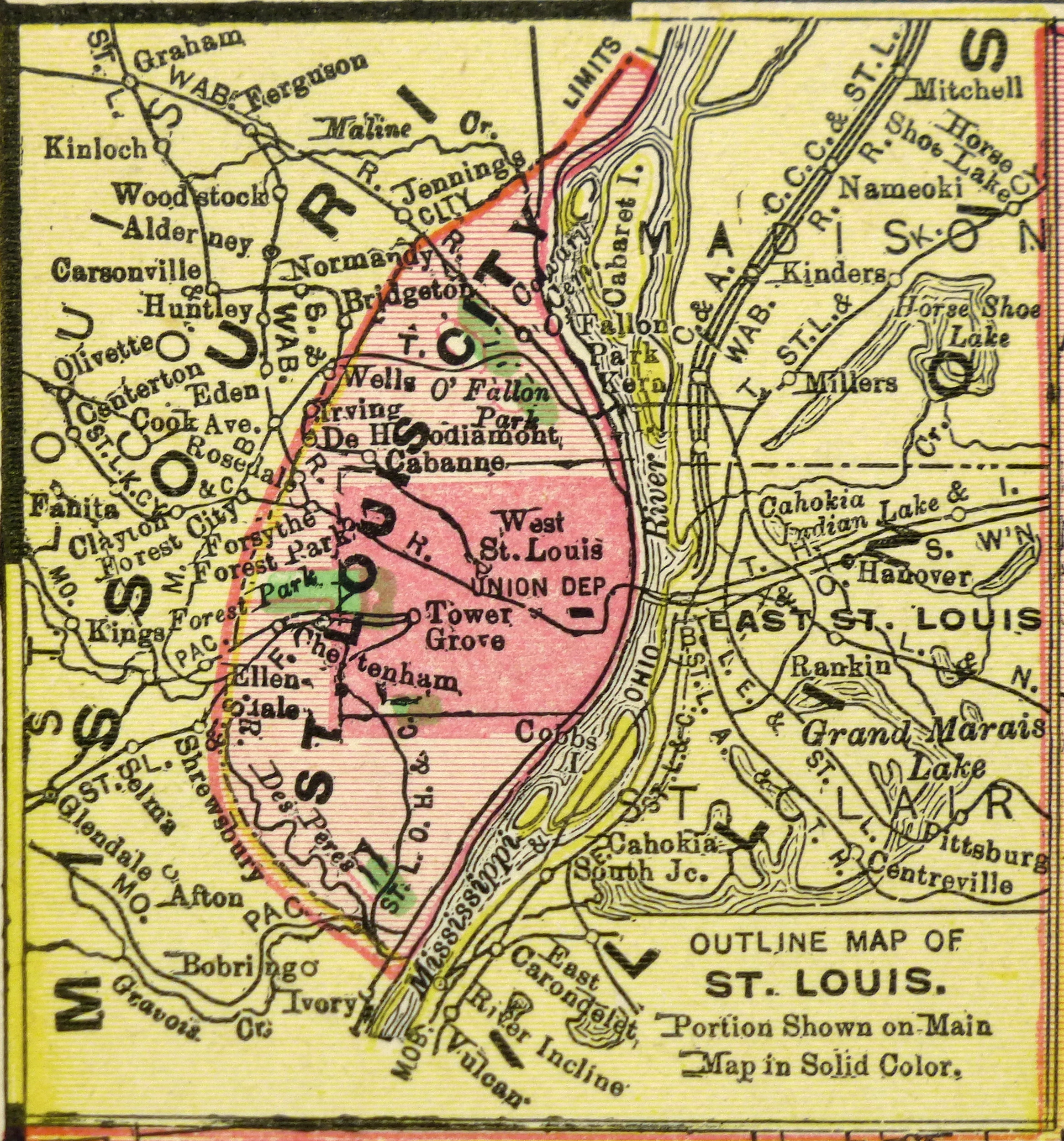
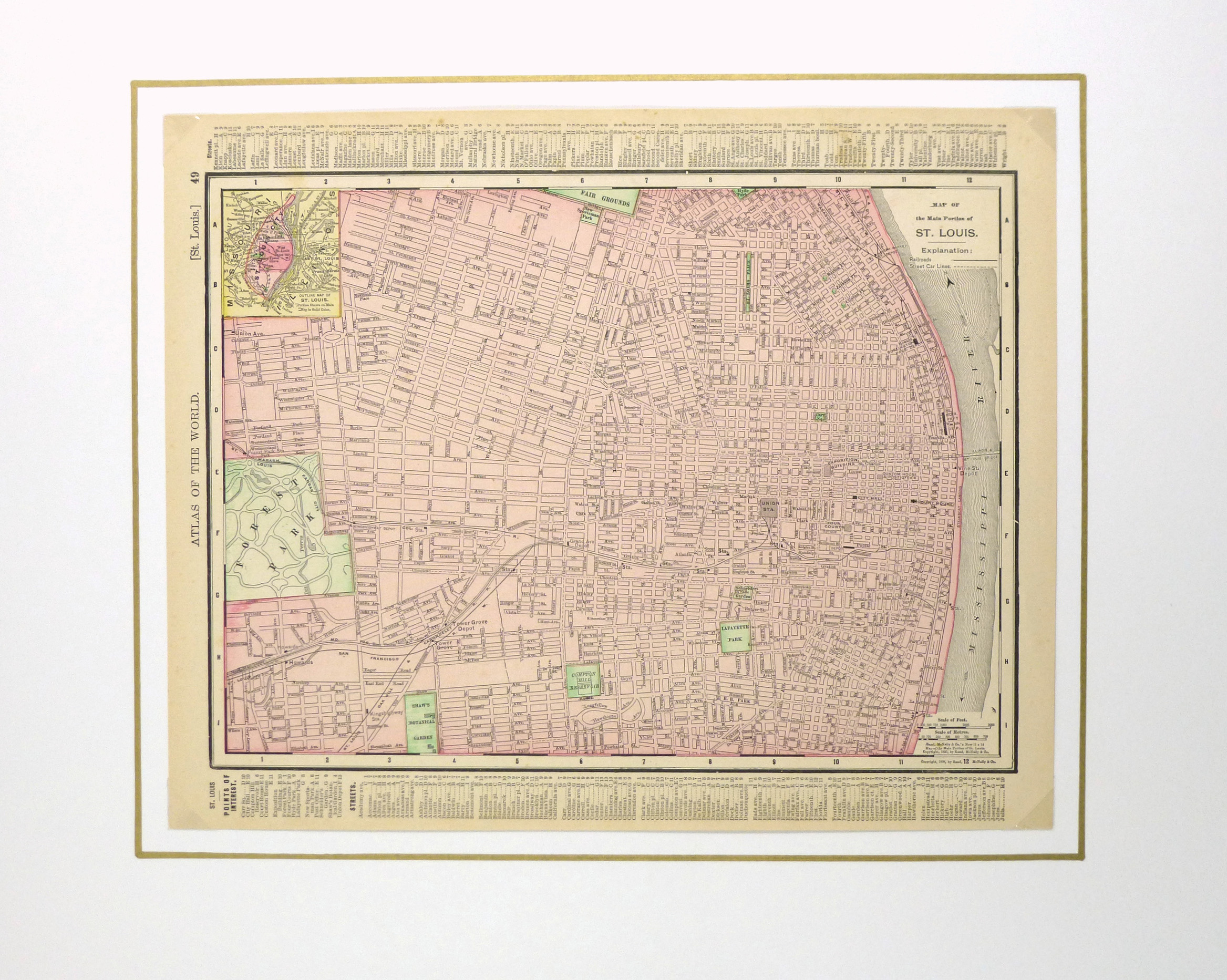


Description
Antique map of St. Louis from 1895. Shows railroads, transport, main buildings, and streets. Note index of streets and monuments.
Original antique map on paper displayed on a white mat with a gold border. Mat fits a standard-size frame. Archival plastic sleeve and Certificate of Authenticity included. Map, 13.75″L x 11.25″H; mat, 20″L x 16″H.