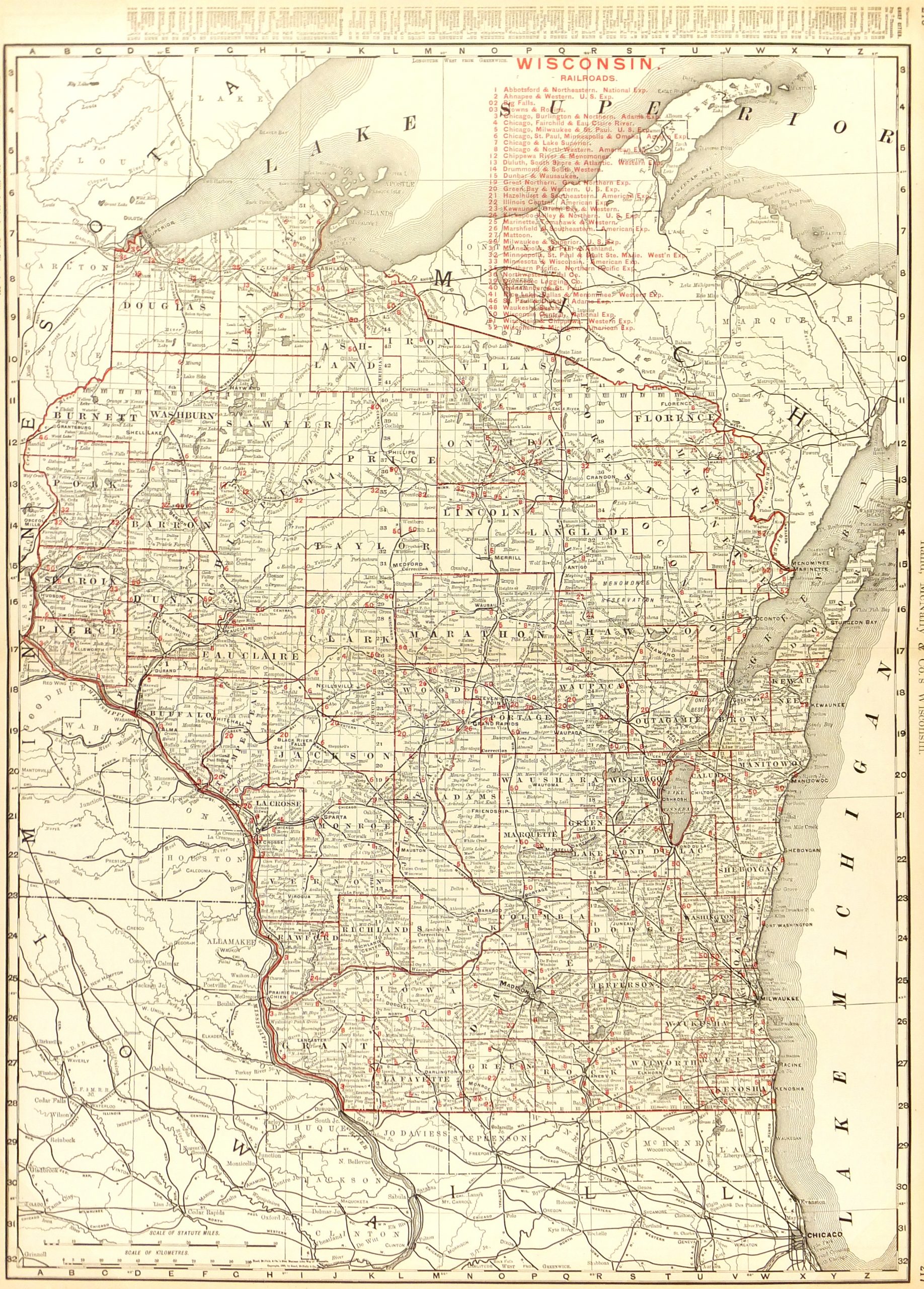
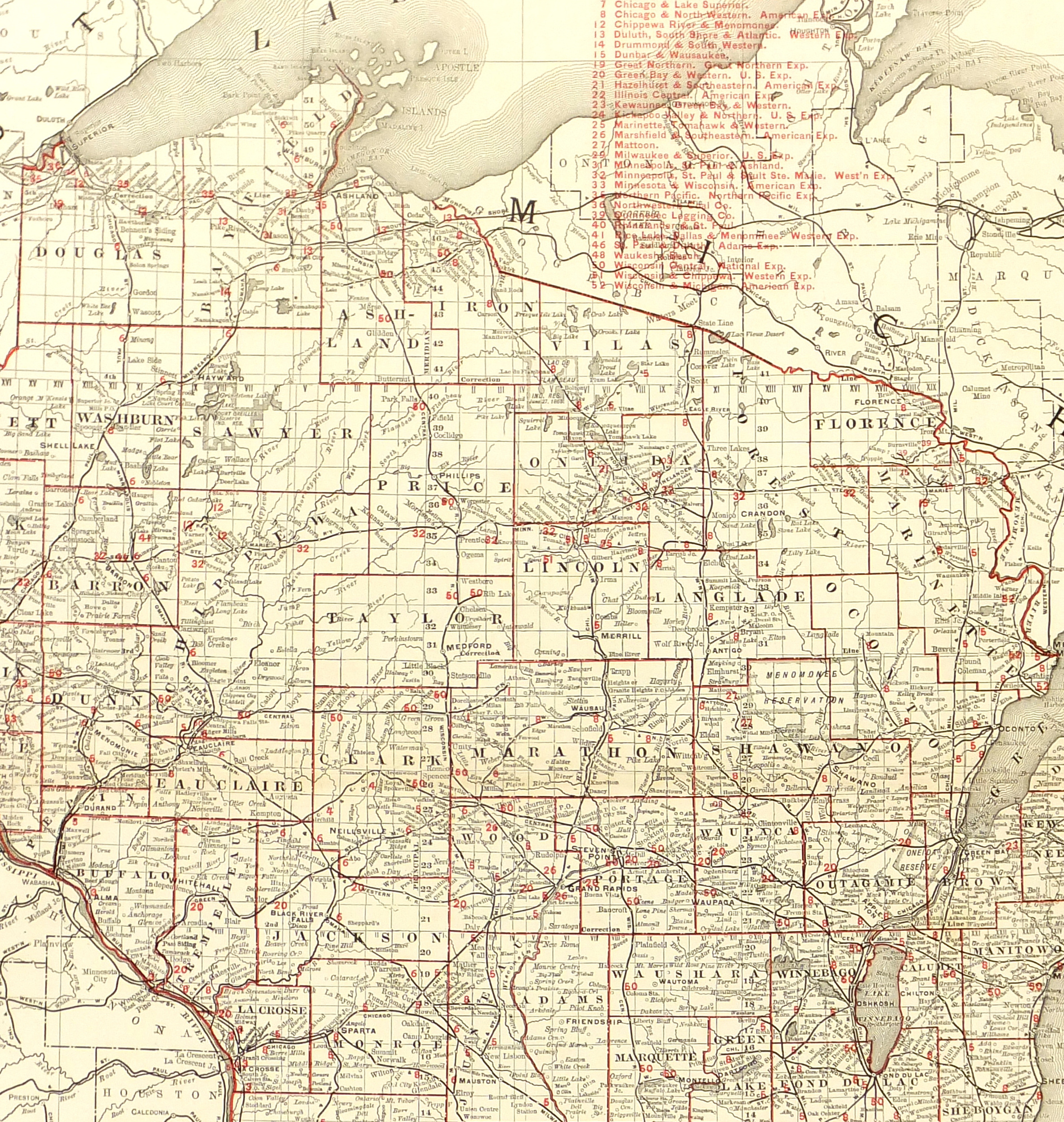
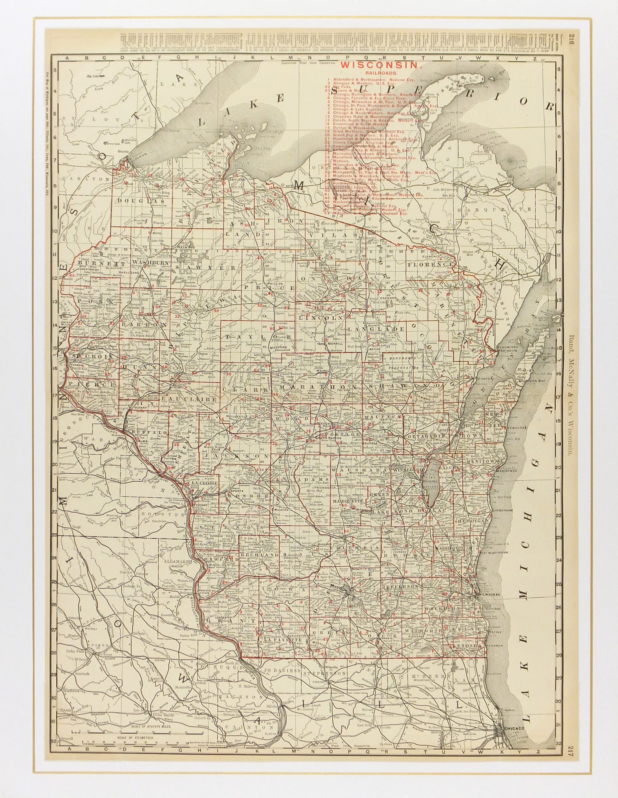


Description
Antique map of the state of Wisconsin from 1895. Shows counties, railroads, and towns. Note interesting index of town populations at top and railroad ownership in red upper right.
Original antique map on paper displayed on a white mat with a gold border. Mat fits a standard-size frame. Archival plastic sleeve and Certificate of Authenticity included. Map, 20″L x 27.25″H; mat, 24″L x 30″H.