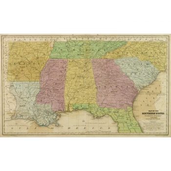
Description
Over 150 year old antique original map of Arkansas, Mississippi, and Louisiana, 1862. Shows counties, roads, rivers, and towns along the Mississippi delta. Original hand color. Intricate decorative border. Note antebellum railroads and more.
Original antique map on paper displayed on a white mat with a gold border. Mat fits a standard-size frame. Archival plastic sleeve and Certificate of Authenticity included. Map, 26.5″L x 18″H; mat, 30″L x 24″H.