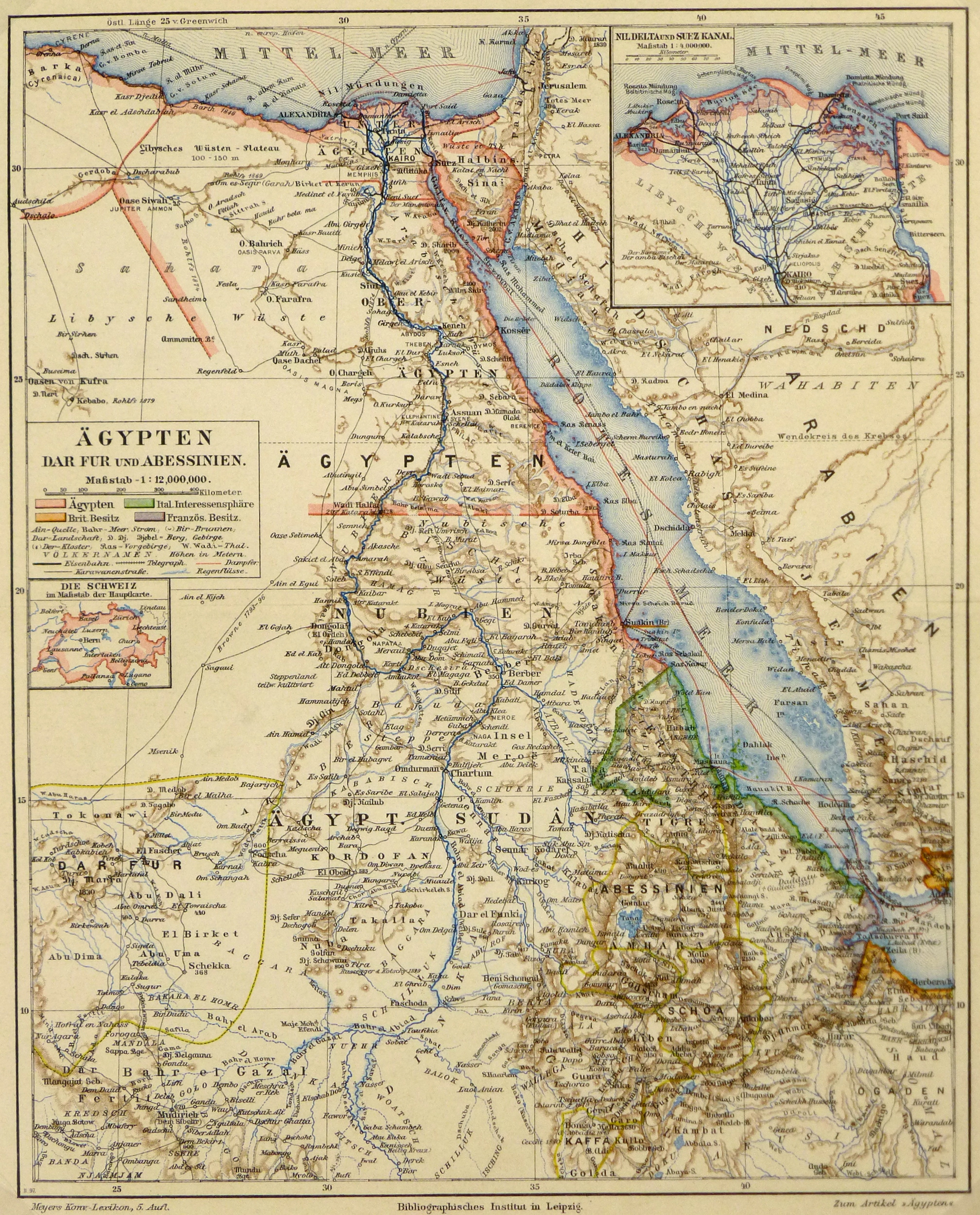
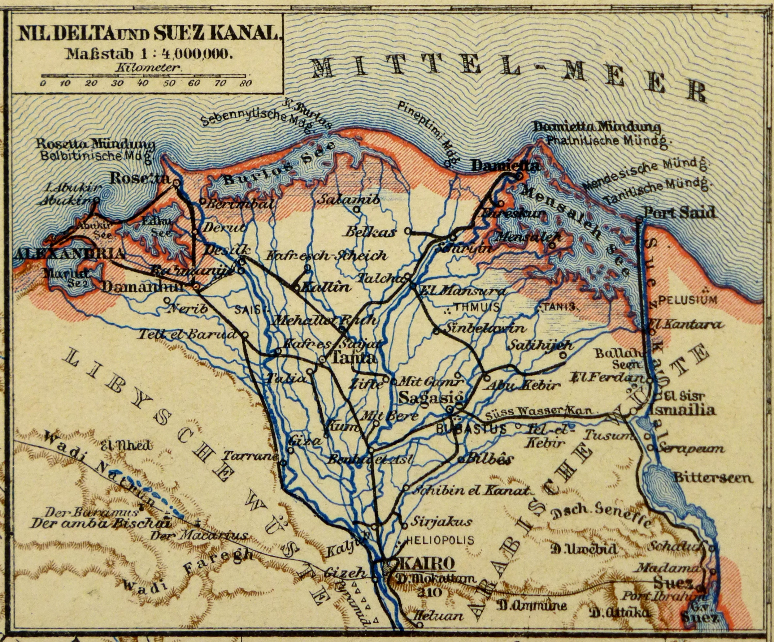
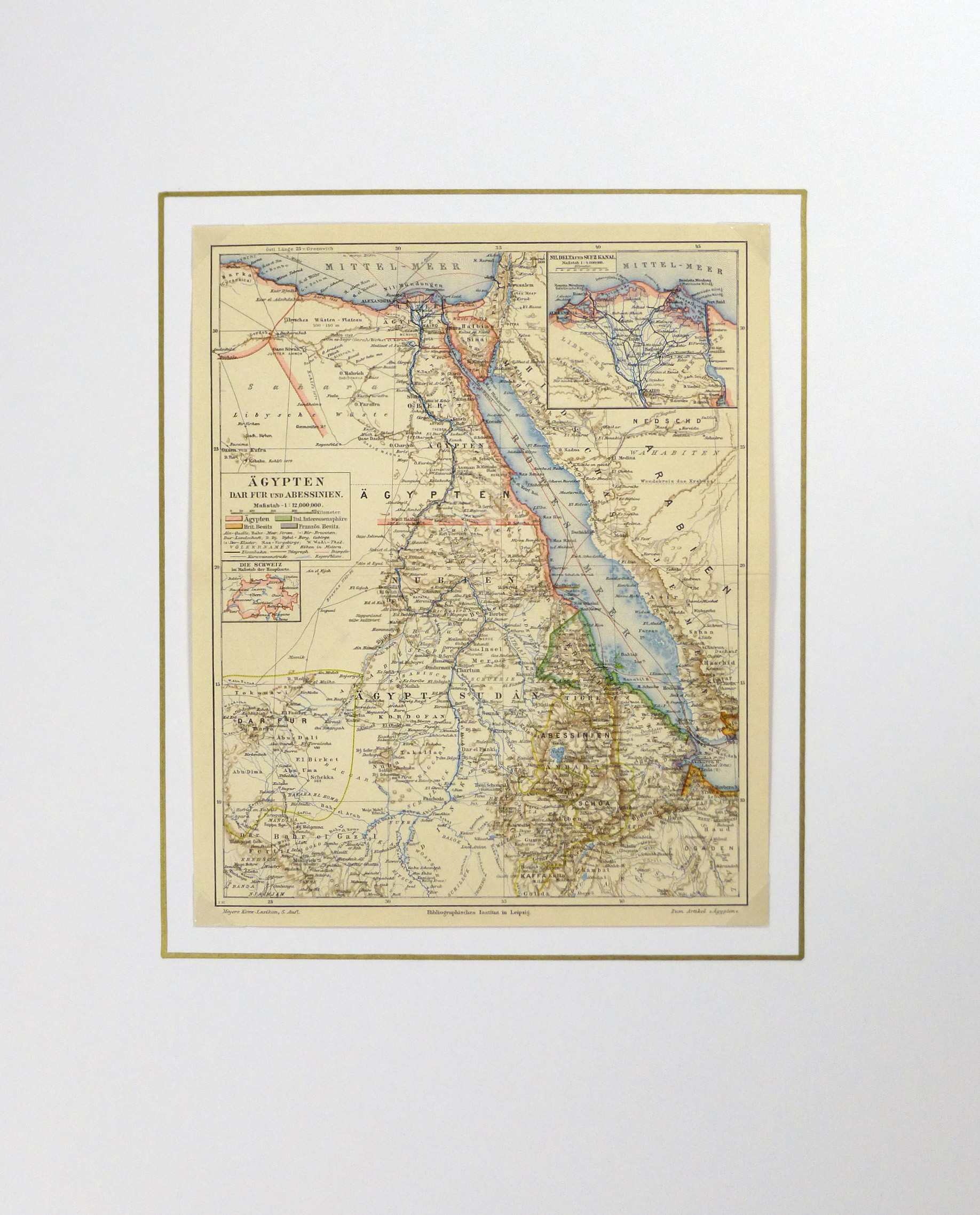


Description
Captivating antique map of the Nile river with Egypt, Sudan and Ethiopia from circa 1880. Shows rivers, mountains, borders and towns. Note many trails and index of colonies left margin.
Original antique map on paper displayed on a white mat with a gold border. Mat fits a standard-size frame. Archival plastic sleeve and Certificate of Authenticity included. Map, 9″L x 11″H; mat, 16″L x 20″H.