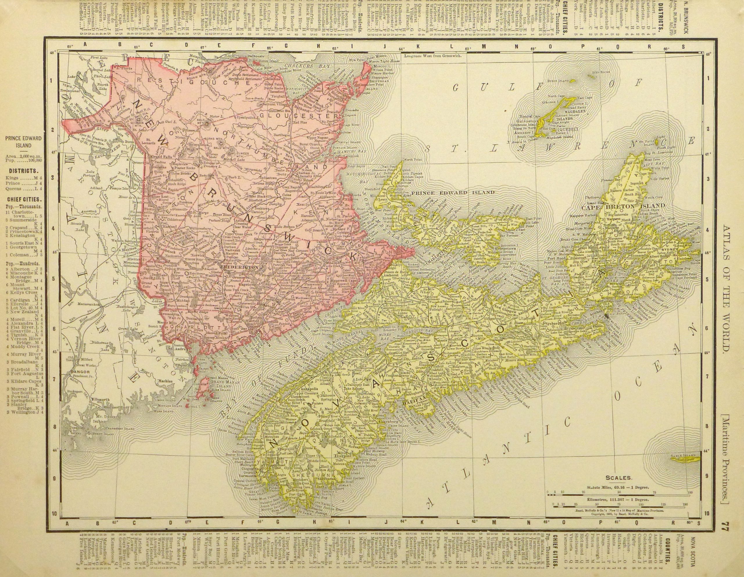
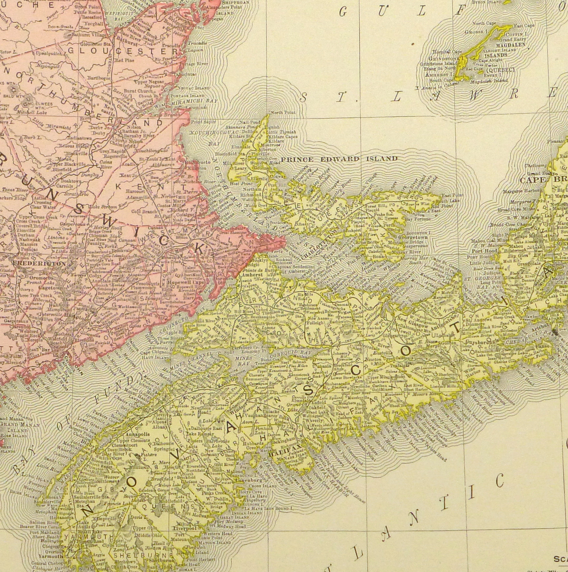


Description
Colorful map of Canada’s three Maritime Provinces including New Brunswick, Nova Scotia, and Prince Edward Islands, 1895. Note index of populations in margins.
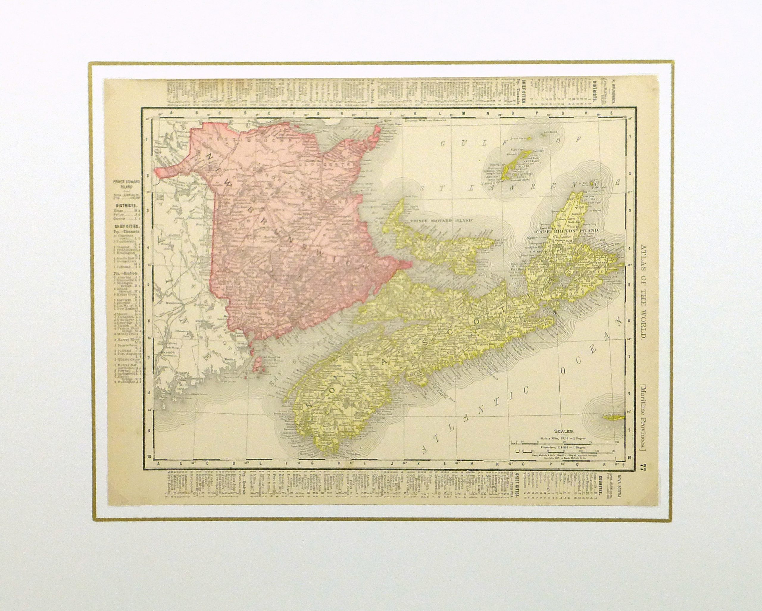
Original antique map on paper displayed on a white mat with a gold border. Mat fits a standard-size frame. Archival plastic sleeve and Certificate of Authenticity included. Map, 13.75″L x 10.75″H; mat, 20″L x 16″H.