

Description
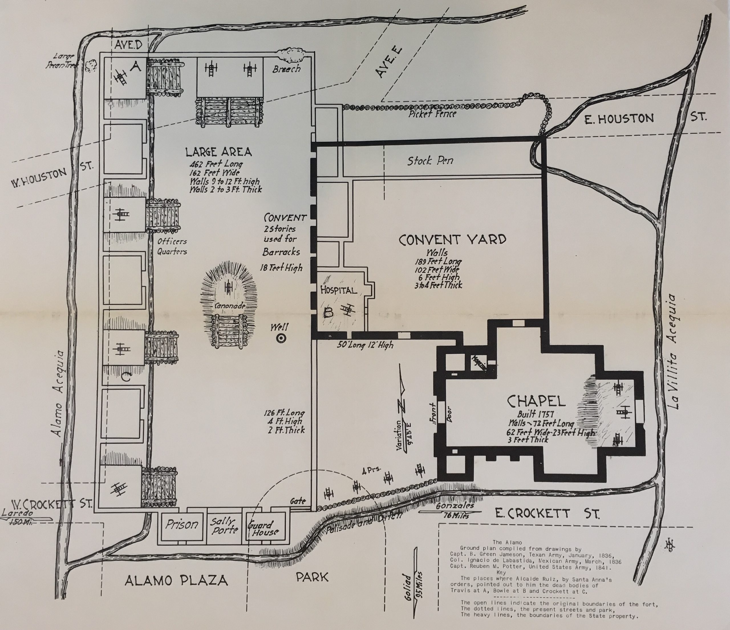
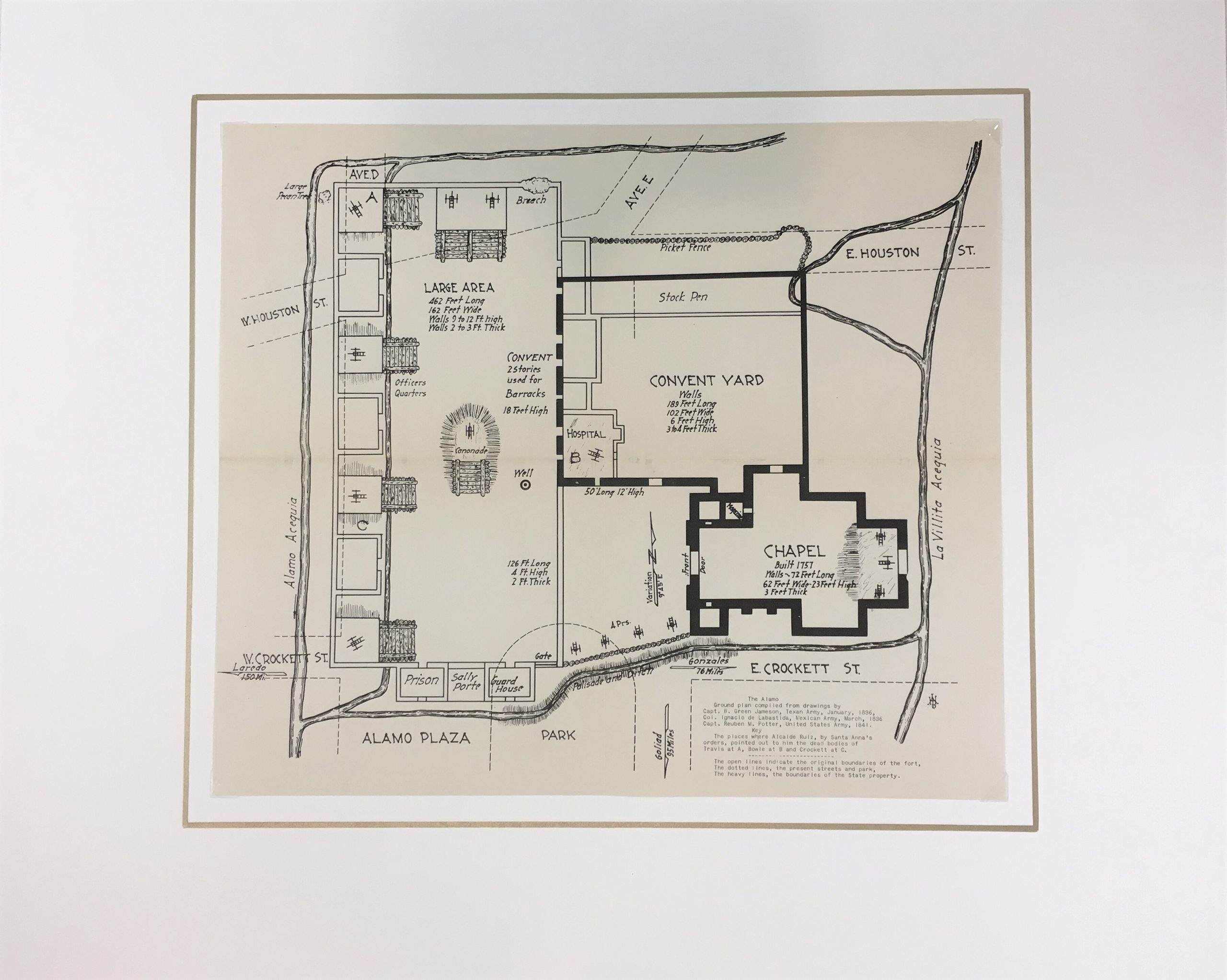
This map shows the layout of the Alamo during the Siege. Â The ground plan was compiled from drawings by Cap. B. Green Jameson (January 1836), Col. Ignacio de Labastide (March 1836), and Capt. Reuben M. Potter (1841). Â The map also identifies locations where Travis, Bowie, and Crockett were found. Map published by Andrew Jackson Houston, 1938.
Andrew Jackson Houston (1854-1941) was the son of Texas Revolutionary hero Sam Houston. A retired colonel of the Texas National Guard, a professor of military science at St. Mary’s University, and a Prohibition Party candidate for Texas governor in 1910 and 1912, A.J. Houston retired to focus on writing about Texas history in 1918. Drawing on a large collection of inherited documents from his father, he wrote and published a book about the history of Colonial Texas, featuring this intriguing series of maps. A.J. Houston died in Washington D.C. on June 26, 1941, two months after his appointment to the U.S. Senate.
Antique map on paper displayed on a white mat with a gold border. Mat fits a standard-size frame. Archival plastic sleeve and Certificate of Authenticity included. Map, 12.5″L x 10.75″H; mat, 20″L x 16″H.